
Articles
The Articles section of Unhinged Geology features insights and commentary on mineral exploration, geology, and resource development. Drawing from real-world field experience and ongoing exploration work, these articles explore topics such as lithium basin geology, geophysical surveys, drilling programs, and emerging mineral districts.
Our goal is to provide clear, practical perspectives on how exploration projects are developed—from early geological concepts to drill targeting and resource evaluation. Whether you are an industry professional, investor, or someone interested in the science behind mineral discovery, these articles offer a deeper look into the methods and thinking that drive modern exploration.
Water Rights, Mining, AI Infrastructure, and the Future of the American West
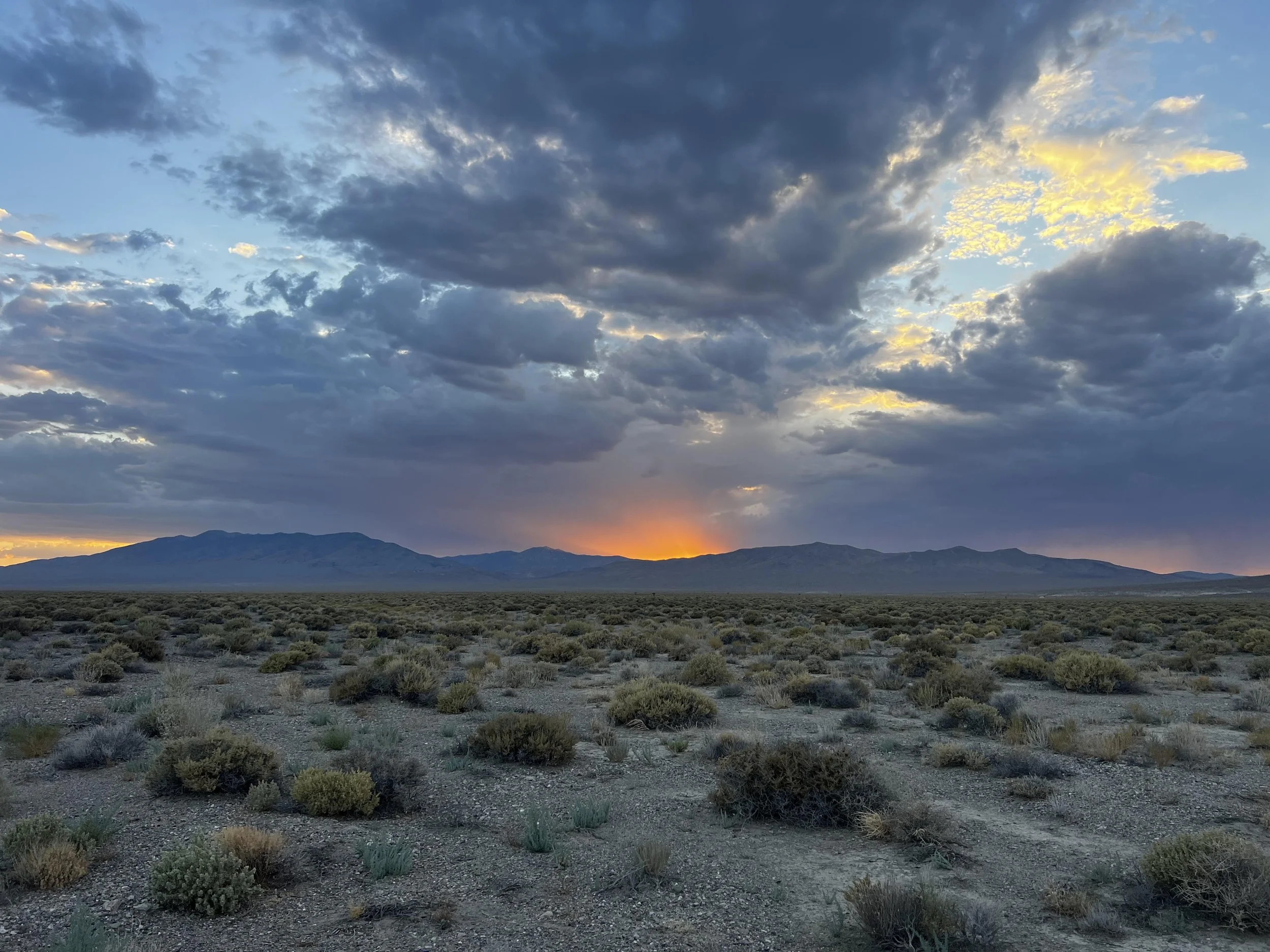
As drought intensifies across the American West, water rights are becoming one of the most critical — and misunderstood — components of modern project development. From lithium mining and mineral exploration to AI data centers and industrial infrastructure, access to reliable water and power is increasingly determining which projects succeed and which fail. This article explores what water rights and water use permits are, how they impact mining and development in Nevada and the broader Southwest, and why the growing competition for water may shape the future of the western United States.
Nevada’s Power Shift: What NV Energy’s Tahoe Exit Could Mean for Mines, Rural Towns, and the Future of the State
For decades, Nevada’s growth story was tied to mining, tourism, and gaming. Today, a new industry is beginning to dominate the conversation: artificial intelligence infrastructure.
NV Energy’s recent decision to stop wholesale electricity deliveries to Liberty Utilities in the Lake Tahoe Basin after May 2027 may seem at first like a regional utility issue affecting about 49,000 California residents. But the implications reach far beyond Tahoe.
This may be one of the clearest warning signs yet that Nevada is entering a new era of electrical competition — one where AI data centers, industrial expansion, lithium processing, and mining projects could increasingly compete for finite power capacity
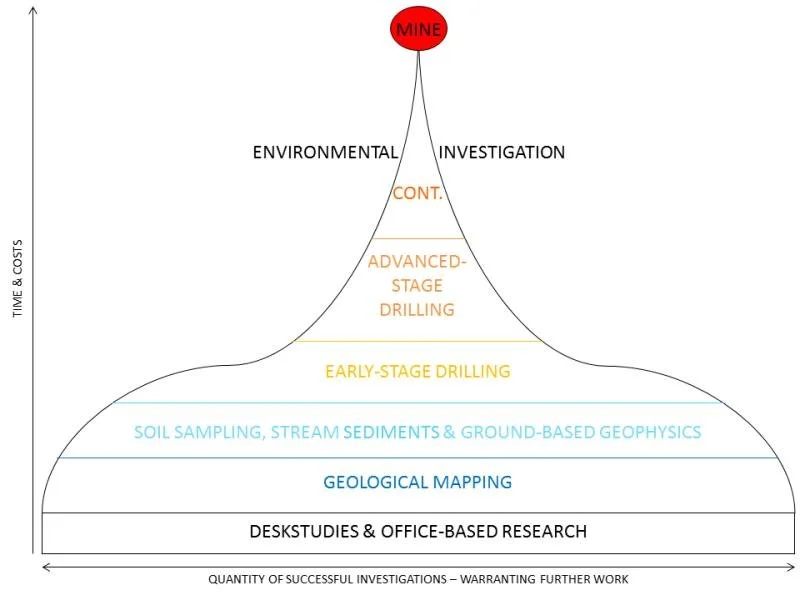
How to Assess the Geological Potential of a Mineral Property (A Brief Complete Guide for Beginners)
This article was developed by Unhinged Geology as a practical guide to evaluating the geological potential of mineral properties, based on real-world exploration experience across Nevada and the western United States.
Unlike academic or theoretical overviews, the framework presented here reflects how mineral properties are actually assessed in the field—from early-stage reconnaissance and data review through geophysics, drill targeting, and model validation. The approach emphasizes integrating multiple datasets into a coherent geological model, with a focus on reducing uncertainty and making informed exploration decisions.
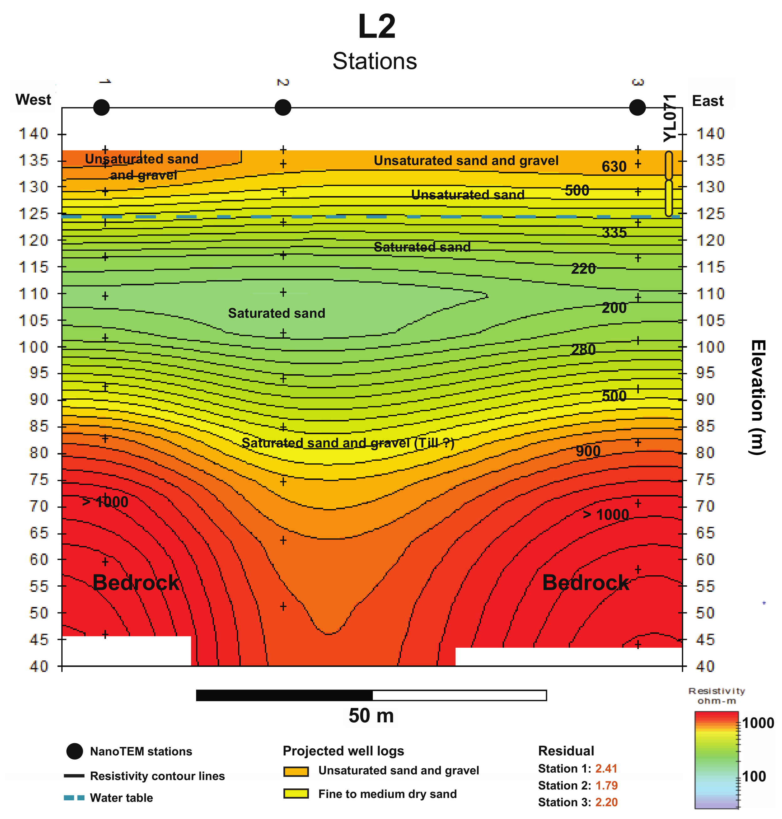
The methodologies outlined in this guide are actively applied in ongoing projects, including clay-hosted lithium exploration programs within Nevada’s Walker Lane structural zone. These projects involve basin-scale interpretation, geophysical integration (including TEM), and drilling strategies designed to test both shallow and deep mineralized systems.
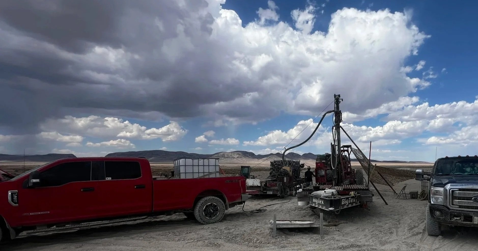
How Rising Diesel Prices Are Quietly Reshaping Exploration Programs
In today’s exploration environment, most discussions around project economics focus on drilling costs, assay turnaround times, and commodity prices. But one of the most immediate and consistently underestimated variables is diesel fuel.
At current field prices—now exceeding $6.50 per gallon in parts of Nevada—diesel is no longer a background cost. It is a primary driver of program efficiency, logistics, and ultimately, project success or failure.
What Is a Mining Royalty—and How Much Is Too Much?
This article explains mining royalties, including NSR, GSR, and NPI, and shows how royalty burden impacts project economics. Using a real-world Nevada case study, we quantify how royalties affect NPV, profitability, and long-term value—demonstrating how even small percentages can result in billions in lost value
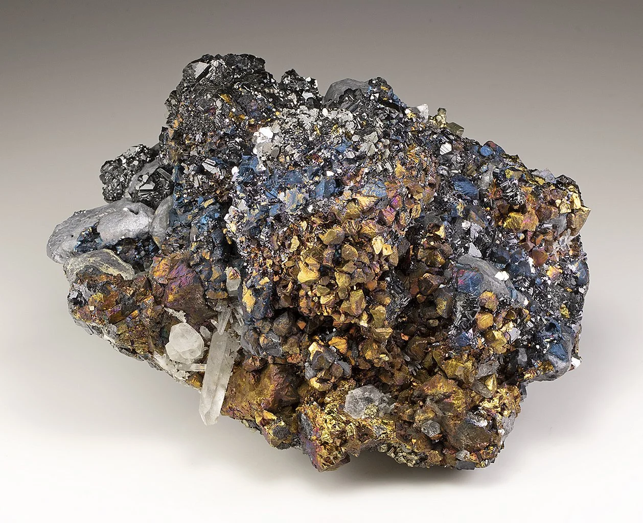
No Deposit Is a One-Mineral Deposit Anymore
Modern mineral deposits rarely contain just one commodity. From silver projects reporting AgEq grades to lithium deposits paired with boron and potassium, exploration geologists increasingly evaluate ore bodies as multi-metal systems where the combined value of several elements determines a project’s true economic potential.
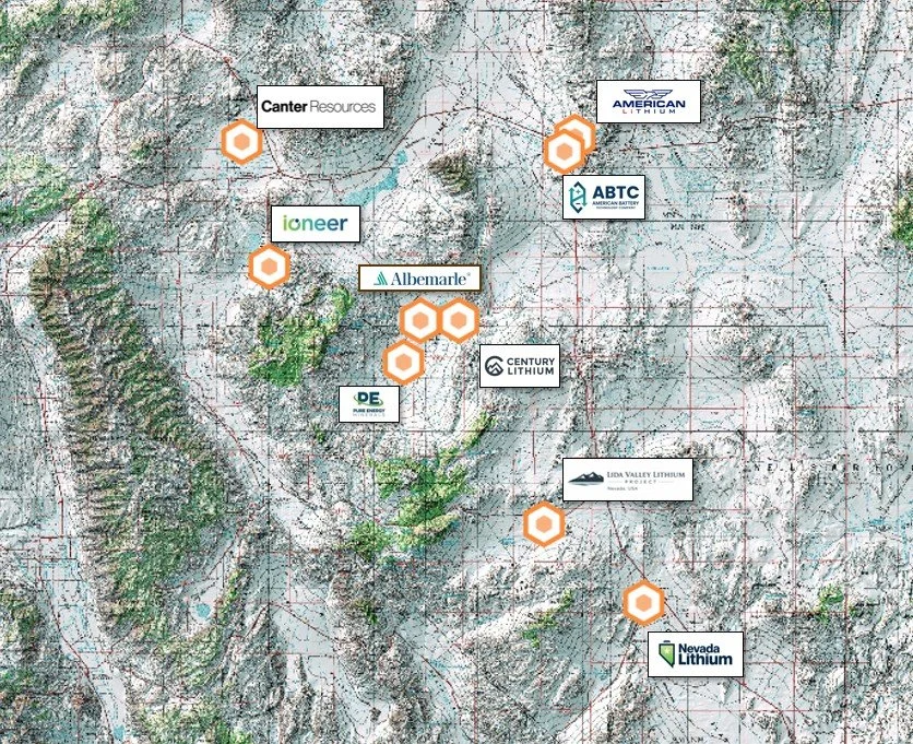
Central Nevada’s Emerging Tonopah Lithium Belt
Central Nevada is emerging as one of the most active regions for lithium exploration in the United States. This article examines the developing Tonopah Lithium Belt, a corridor of lithium projects surrounding Tonopah, Nevada, and explains the geological processes, basin structures, and exploration factors driving new lithium discoveries in the region.
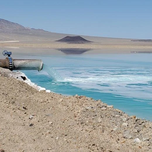
Lithium Brine Deposits: How Lithium Is Concentrated in Salt Lakes
Lithium brine deposits are one of the world’s most important sources of lithium. This article explains how lithium-rich groundwater accumulates in closed desert basins, how evaporation concentrates lithium in brines, and how these deposits are explored and extracted to supply lithium for batteries and energy storage.re
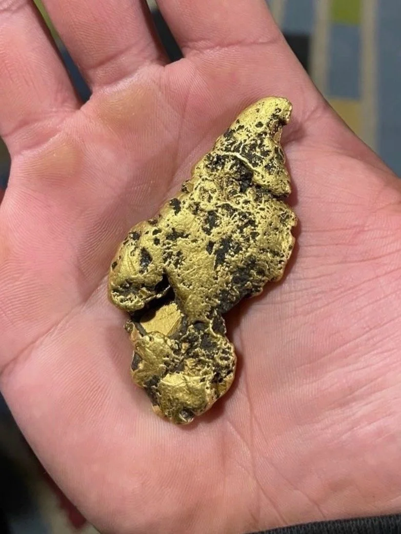
10 Field Signs an Ancient Drainage May Contain Gold
In many parts of the western United States, particularly in arid regions such as Nevada, placer gold is often found in ancient drainage systems rather than modern streams. These abandoned channels, known as paleochannels, once carried flowing water that eroded gold from mineralized bedrock and concentrated it within gravel deposits.
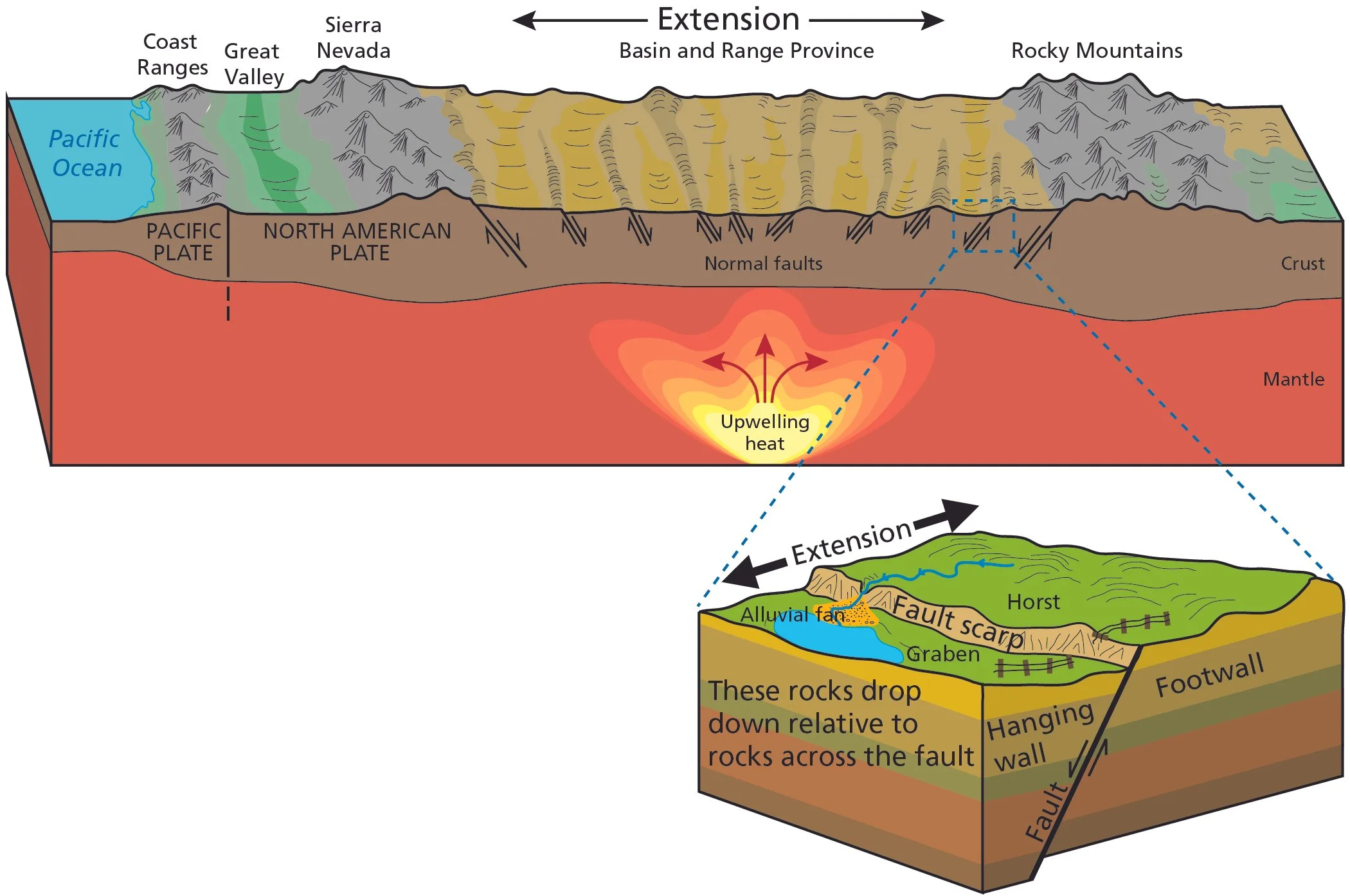
Why Nevada Is Becoming the Center of U.S. Lithium Production
Nevada has emerged as the center of U.S. lithium exploration and development due to its unique Basin and Range geology, lithium-rich claystone basins, and mining-friendly environment. This article explains how volcanic activity, closed basin systems, and major projects such as Thacker Pass, Rhyolite Ridge, and Clayton Valley have positioned Nevada as a key hub for future lithium production.
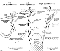
Low-Sulfidation Epithermal Gold & Silver Systems
Low-sulfidation epithermal gold and silver systems form in shallow crustal environments where hydrothermal fluids rise along structurally controlled pathways and deposit metals within veins, stockworks, or breccia zones¹. In Nevada-style systems, extensional tectonics — commonly associated with Miocene Basin and Range volcanism — create fault networks that serve as fluid conduits and depositional traps
How Clay-Hosted Lithium Deposits Form
Clay-hosted lithium deposits form in tectonically active, internally drained basins where volcanic material is weathered, transported, and ultimately concentrated within fine-grained lake sediments. Over time, lithium becomes incorporated into clay minerals through chemical processes linked to evaporation, sedimentation, and diagenesis.
While surface intercepts and assay values often draw attention, the true scale of a clay-hosted lithium system is governed by basin architecture — fault geometry, subsidence history, and stratigraphic continuity. Understanding the structural framework of a basin is often more important than any single drill hole.
This briefing examines how these systems form and why architecture, not isolated assays, determines exploration success.
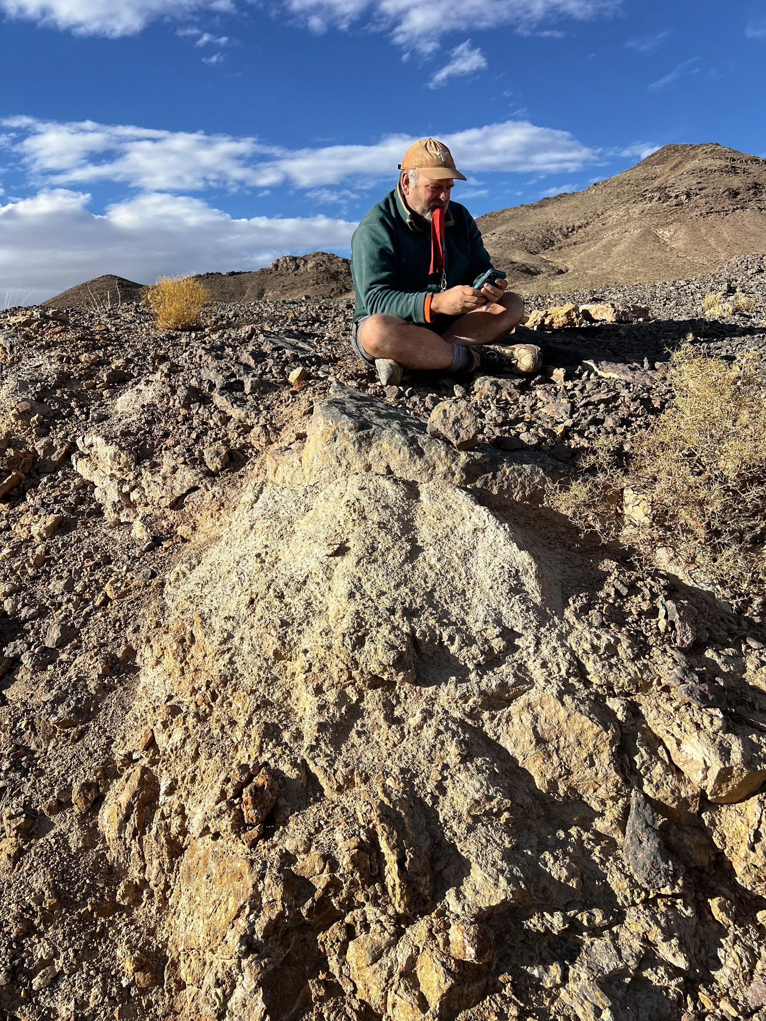
The Importance of Detailed Geological Mapping in Mineral Exploration
Detailed geological mapping remains one of the most important tools in mineral exploration. By documenting rock units, structures, and alteration patterns, geologists can identify controls on mineralization, refine drill targets, and build reliable geological models. Modern tools such as drones, tablets, and GIS are now transforming how field mapping is conducted.